
This walk takes in the viewpoint of Colmers Hill ~ offering great views across the countryside and Jurassic Coast before exploring the deep galloways of Hell Lane and the little hamlets before descending to Seatown. The return walk follows a steep valley with more views of Colmers Hill and the coast.
Walk Summary
This walk takes in the viewpoint of Colmers Hill ~ offering great views across the countryside and Jurassic Coast before exploring the deep galloways of Hell Lane and the little hamlets before descending to Seatown. The return walk follows a steep valley with more views of Colmers Hill and the coast.
Walk Details
Difficulty
Easy
Easy/Moderate
Moderate
Moderate/Hard
Hard
Very Hard
Distance
Up to 3 miles
Up to 5 miles
Up to 10 miles
10+ miles
Suitability
Dog Friendly
Child Friendly
Pushchair Friendly
Wheelchair Friendly
On Site Parking
No Car Needed
On Bus Route
Close to a Train Station
Restaurant/Cafe
Toilets
Description and Information
Starting at the Symondsbury Estate car park (there is also parking in the village), take the footpath at the top of the car park and follow the signs for Colmers Hill. Don’t worry if you miss the holloways and sunken paths as you head towards the hill, you can easily visit them on the return part of the walk.
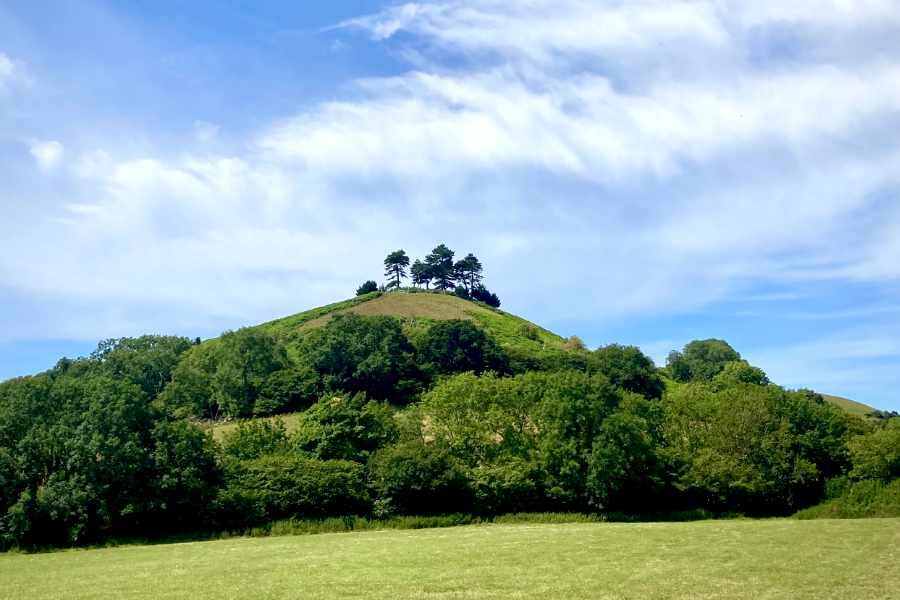
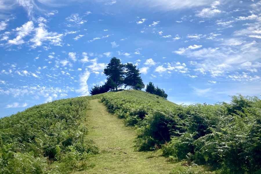
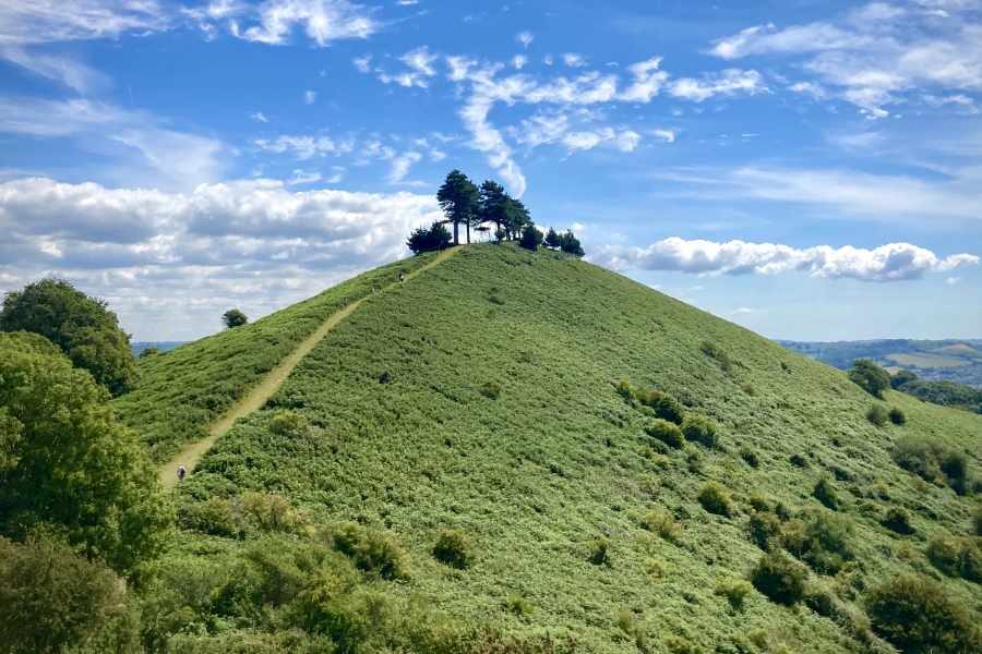
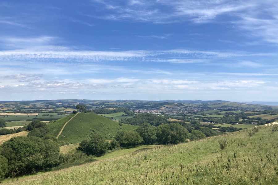
Colmers Hill, a near-conical sandstone mound, is topped by pine trees. It’s highly visible and can be easily seen from the main street in Bridport, its significance extends back to around the 11th century. The hill takes its name from the “Colmer Tenement”. The family were tenants of the Dukes of Somerset and Earls of Ilchester in the 17th and 18th centuries, and the Rev. John Colmer was the rector from 1805–06.
During World War I Scots Pine trees were planted on the summit by Major W P Colfox MC and the hill now forms an iconic subject for artists and photographers.
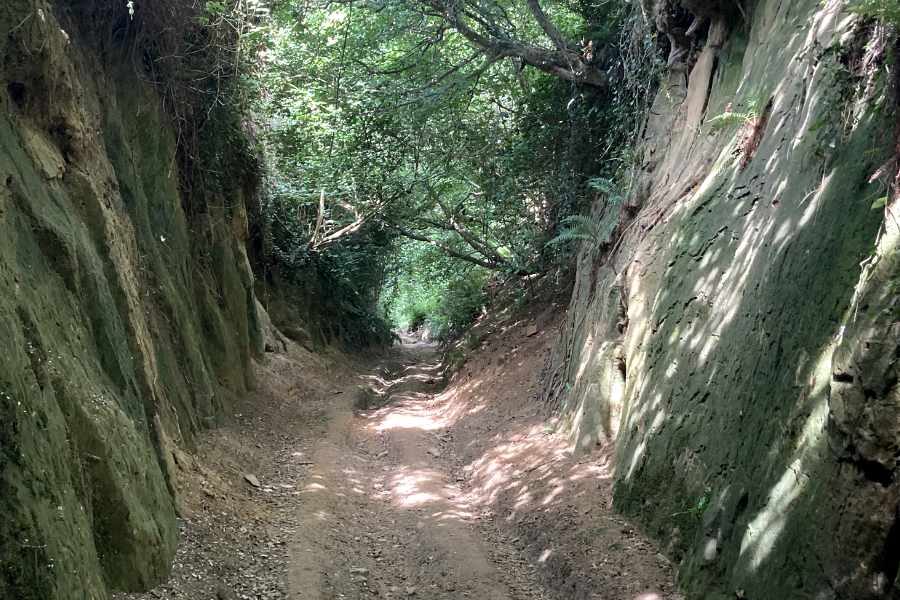
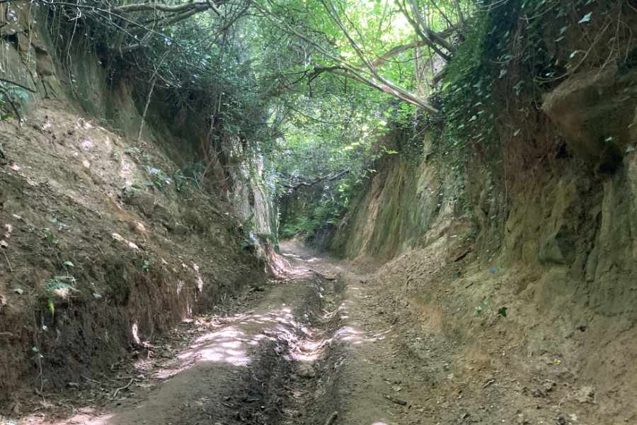
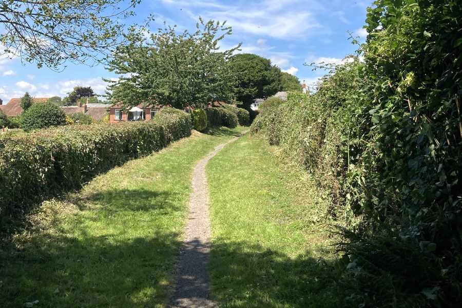
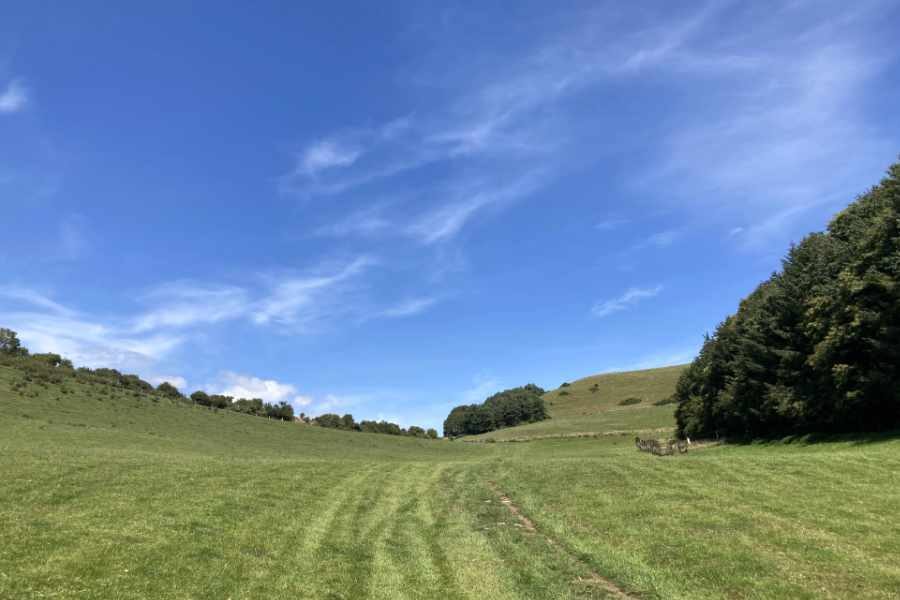
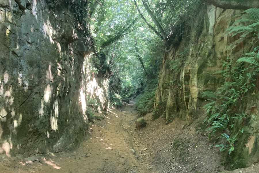
Head back down the hill and follow the footpath across the field until you reach the gate and five crossroads — take the second path on the left down Hell Lane, don’t let the name frighten you, it’s a pleasant down-hill walk, but can get very wet and muddy so make sure you wear appropriate footwear (as you reach the bottom, you may have to pick your way across a small stream).
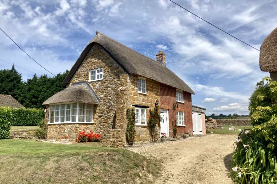
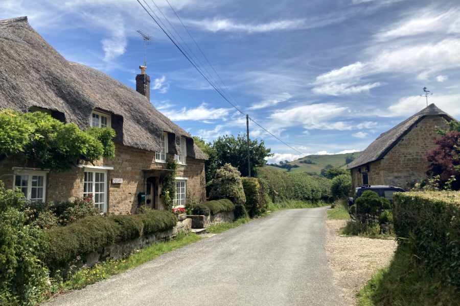
Continue to follow the path until it turns into a road, and then keep following until you reach North Chideock and the junction of Butt Land and North Road. Don’t be tempted to cut the corner and take the footpath, or you will miss some beautiful cottages and gardens. Turn left at the junction and follow North Road all the way to Chideock. Be careful when crossing the road and then turn right into Duck Street, continue and follow the road as it turns into Sea Hill Lane all the way to Seatown.
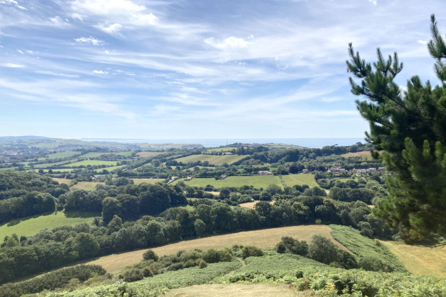
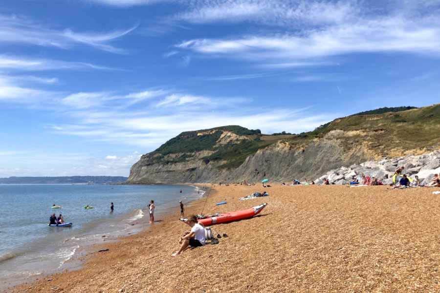
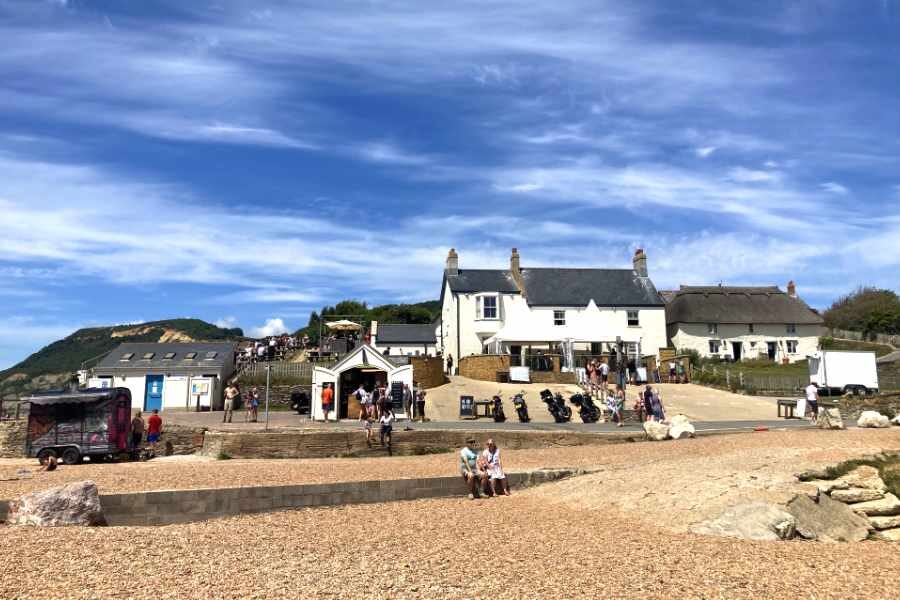
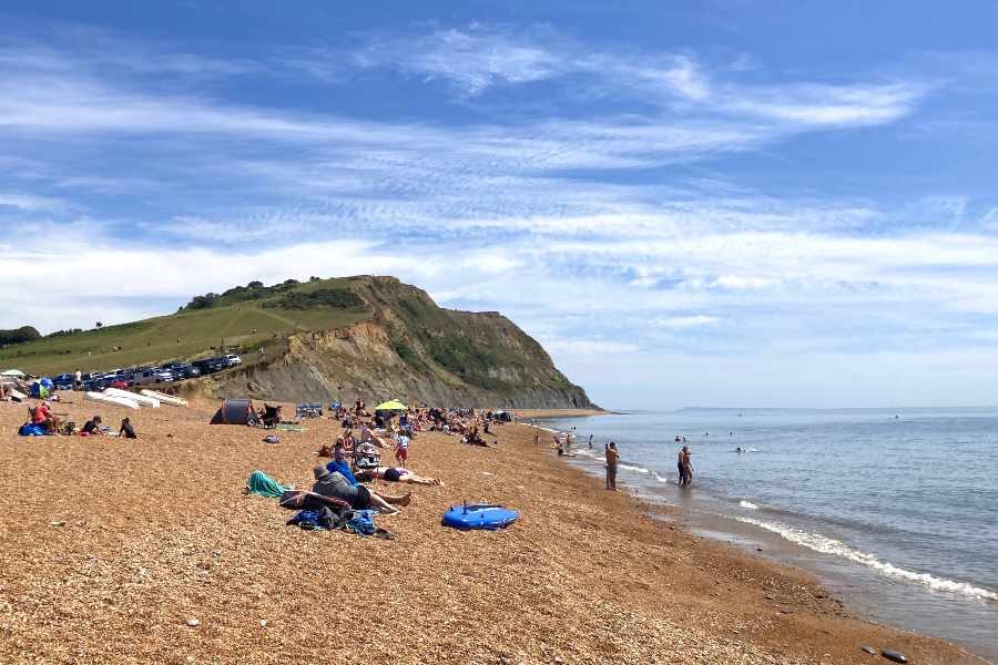
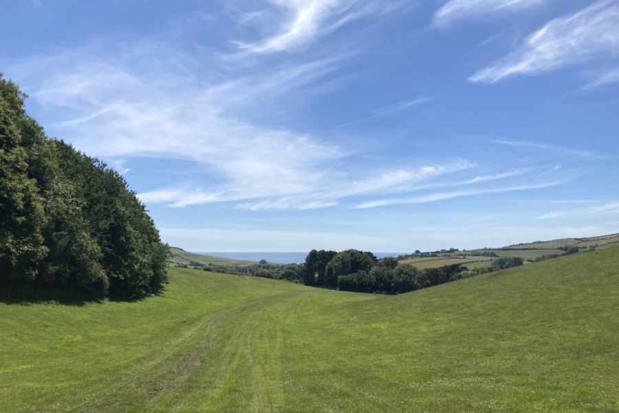
Seatown sits on the Jurassic Coast, and the surrounding area is also designated part of the Dorset Area of Outstanding Natural Beauty. Golden Cap, the highest point on the south coast of England, lies to the west — if you’re feeling energetic you can easily follow the footpath to the top. Seatown comprises a small number of houses, a holiday park, some holiday cottages and The Anchor pub which offers food all day. The pebbly beach is privately owned but free to access and great for a picnic.
As you head away from the beach, take the footpath (Mill Lane) to the right of the holiday park. Stay on Mill Lane for a while, then take the footpath on the right over a footbridge and through a small play park and continue to the main road in Chideock. Turn right and cross over the road (take care as you cross) and follow the pavement past The George Inn and look out for the footpath on the left (near the end of the pavement)
Follow the footpath past some farm buildings and continue up and across the fields towards the top of the hill. The footpath follows the curve of the hill and there’s a stile is hidden amongst some trees, continue up the path until you reach a gate in the corner. If you fancy a bit more of a climb, continue up the hill to the right, where there’s a good view of Colmers Hill.
Continue though the gate, and you will be back at the five crossroads. Take the second track on your right (it maybe signposted as Shute’s Lane) and head down through the sunken path and field back to the car park. Note: you can either follow the signs to the car park or follow the track all the to the Symondsbury and then take the road to the left and past the church back to the car park.
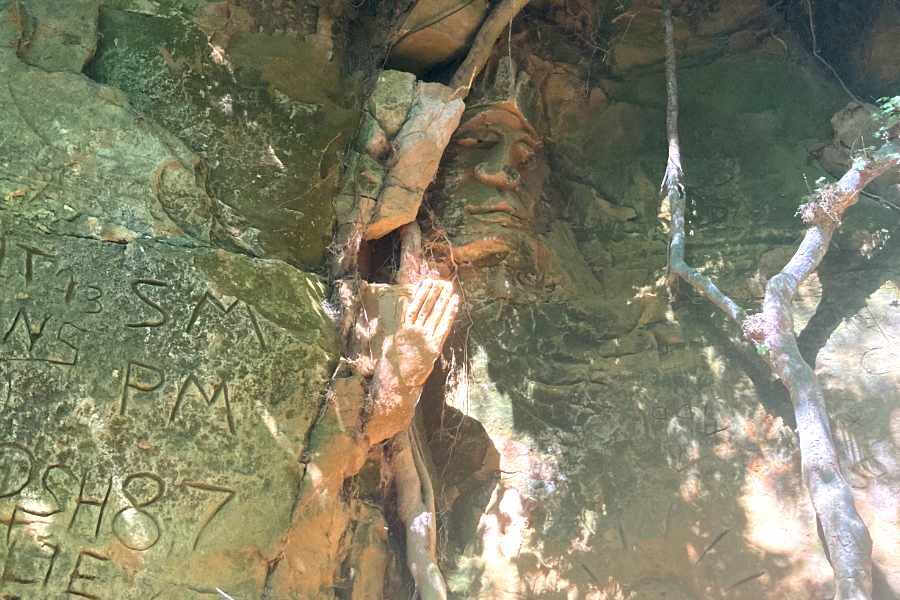
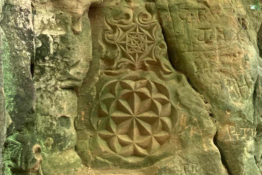
Hell Lane is perhaps one of the most impressive and interesting parts of this walk. With Shute’s Lane it connects Symondsbury with North Chideock, climbing up over the ridge near Quarry Hill. Keep an eye out for carvings, faces and hidden markings as you walk the holloways and sunken paths.
Walk Gallery
Walk Location Information
Start Location
Symondsbury Estate, DT6 6HG
OS Grid Reference
SY 44532 93791
Download GPX Route
If you use a GPS device or mapping application on your smart phone, such as OS Maps, you can use this GPX file to follow the walk.
Route Information