
Studland to Agglestone Rock Walk
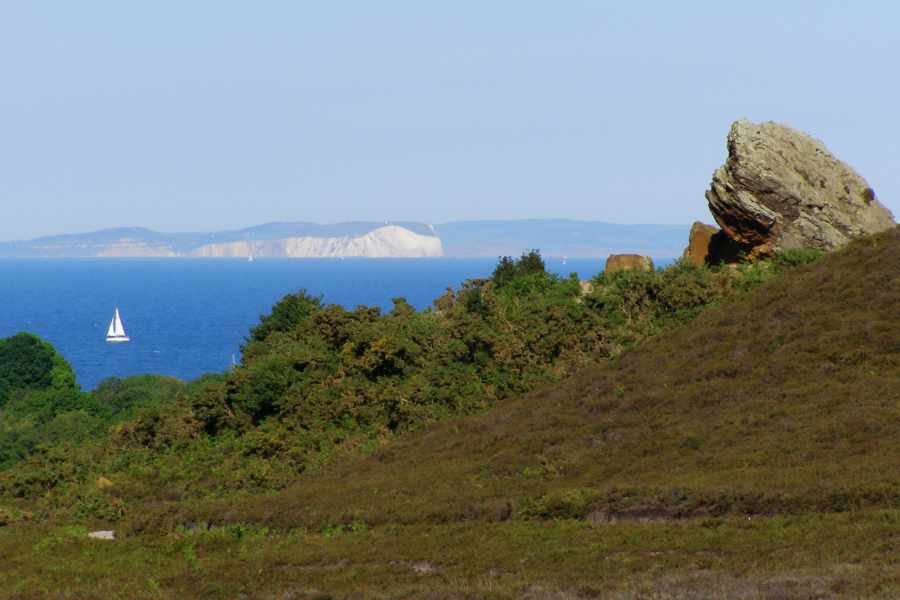
This walk starts in the beautiful village of Studland, famous for its beaches and nature reserve. The walk is approximately 3 miles long and offers great views across Poole Harbour, Studland Beach and on a clear day Sandbanks, Bournemouth and the Isle of Wight.
If you have the energy, you can also walk along the beach or take the footpath along the cliffs to Old Harry Rock, or perhaps they can be saved for another day.
Start at Middle Beach Car Park, Studland.
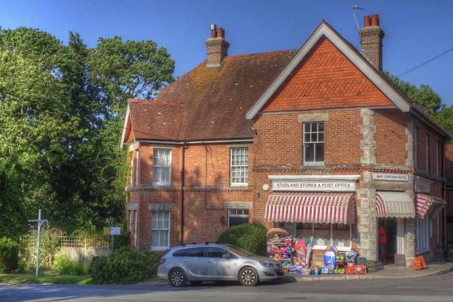
From the car park walk up Beach Road. At the top turn left between the toilet block and the village pond. Take the narrow path at the top of the green. It will take you past an ancient pear tree and the remains of an old stone cottage, before bringing you out in front of Studland Stores.
Cross the main road and continue along Heath Green Road. Turn right down Agglestone Road and follow the track up behind the houses, the kissing gate at the end of the track brings you onto Godlingston Heath.
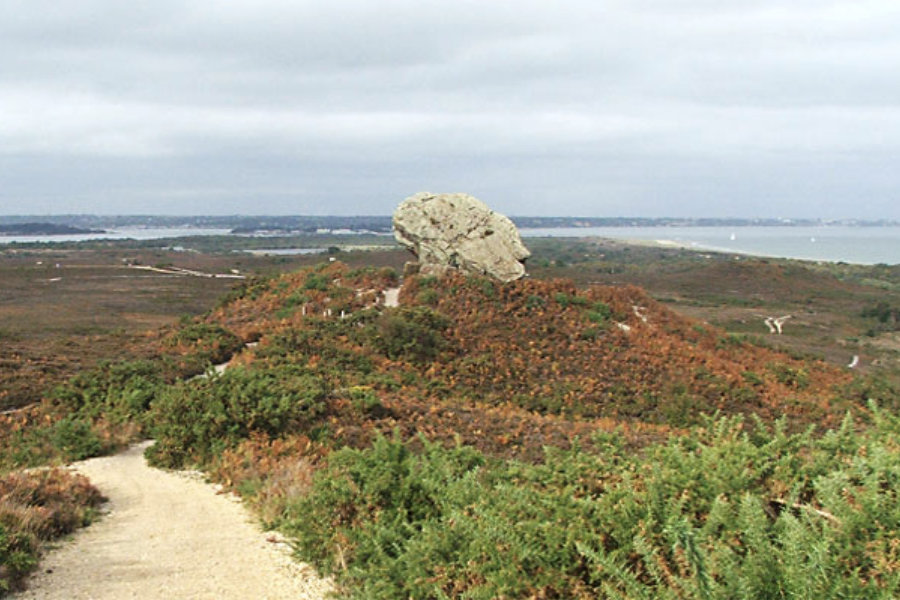
Follow the path uphill onto Black Down Mound, where you will be rewarded with wonderful views to your right across the heath to the coastline, with the impressive Agglestone in the distance.
Continue along the ridge and when you meet the gravel track, turn right and follow the path down to the Agglestone. From here you can see Poole Harbour and Little Sea in the distance: an acidic freshwater lake that was cut off from the sea around 100 years ago.
Take the path that leads down the slope on the other side of the Agglestone and follow the path through the mire. Where the path forks, take the right path heading towards the trees.
Turn right at the next junction, heading into the woodland. Then turn right again over the bridge and continue through the bridle gate. Just after Wadmore Farm House, you will see an old brick kiln on your right.
After passing the kiln, take the footpath on your right. It is immediately after, and runs adjacent to, the bridleway. At the next junction, follow the footpath round to the left. As the track widens, keep to the right and continue along the footpath in front of you until you reach Heath Green Road. Turn left and follow the road back towards Studland Stores.
Cross the main road and follow the path back to Beach Road and your starting point.
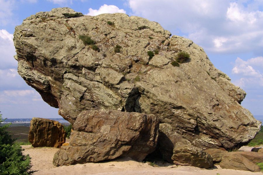

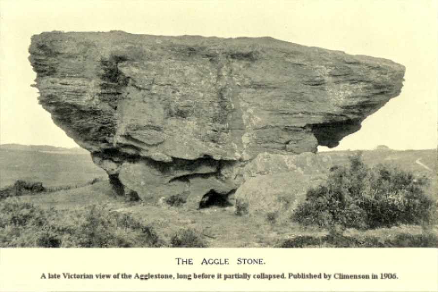
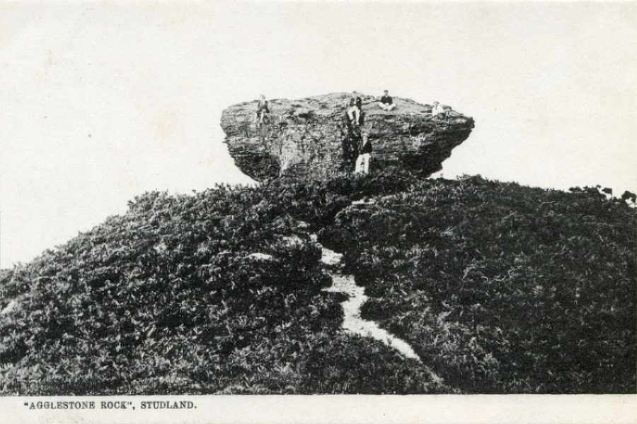
On Studland Heath approximately 1 mile north-west of Studland stands a strange rock formation called The Agglestone. Locally it has associations both in myth and legend with the devil who is said to have hurled the rock from the Needles on the Isle of Wight, to where it stands today but, as we all know and is often the case, he missed his target by many miles. The strange rock formation has been gradually eroded away over many thousands of years by the wind and rain.
Aggle ~ taken into the old Dorset dialect as meaning “to wobble”.
Map and Points of Interest
Middle Beach Car Park
Beach Road, Studland, Dorset, United Kingdom, BH19 3AX
Aggleston Rock Os grid reference: SZ 0236 8282
Download GPX File
Studland to Agglestone (407 downloads )Public Transport
Morebus: Breezer 50 Bournemouth to Swanage via Westbourne, Canford Cliffs, Sandbanks, Studland.